| |
|
| Menü |
Detailansicht |
|
|
| ID | 2841 |
|---|
| Datum | 17.10.2016 |
|---|
| Land | E |
|---|
| Gebiet | Mallorca |
|---|
| Gipfel | Na Pòpia |
|---|
| Höhe | 349m |
|---|
| Route | Rother #6, Bootsüberfahrt nach Sa Dragonera (Dracheninsel), Infozentrum des Naturparks, Asphaltweg Nr.3/4 vorbei an der Cas Garriguer, Schotterweg Nr.4 in vielen Kehren zum Mirador des Coll Roig 98m und weiter zur Ruine des alten Leuchtturms Far Vell |
|---|
| Talort | Sant Elm |
|---|
| Ausgangspunkt | Bootsanleger Es Lladó 2m |
|---|
| Stützpunkt | Restaurants und Cafes in Sant Elm |
|---|
| Mit | Brigitte |
|---|
| Notiz | 39°35'10,5N,2°19'1"O |
|---|
| Tourentext | Abstieg wie Aufstieg und Bootsfahrt nach Sant Elm |
|---|
| Link | http://www.gpswandern.de/gpxviewer/tvanzeige.shtml?url=http://walter.bergliste.at/tracks/2016.10.17 Na Popia.gpx |
|---|
| Bild | 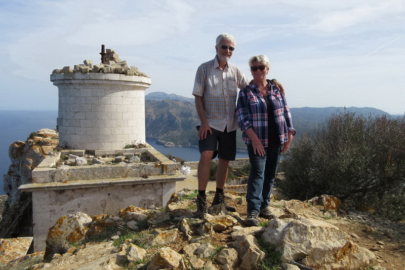 |
|---|
| Karte | |
|---|
|
